 |
| A panorama view from Blue Hill Observatory. Boston is that smattering of buildings in the distance. |
Planning
The Skyline Trail
The Skyline Trail is a very popular trail in the Blue Hills Reservation located south of Boston. This trail basically goes across the entire reservation from east to west (or west to east, depending on how you look at it). On the western end of the trail is Blue Hill (it goes on farther, but many people start/end there) and on the eastern end are the St. Moritz Ponds. According to this site, the full round-trip of the Trail is about 16 miles. However, if you have done any hiking in the White Mountains (or any other mountainous region), then this is not the same "16 miles" that you are used to. The highest peak (Blue Hill) is a whopping 635 feet (211 m) high. To put the into perspective, the John Hancock Tower in Boston is 790 ft (240 m). Oh, and the Sears Tower in Chicago is 1450 feet (442 m) high. So yes, not a very big hill. That being said, the Skyline Trail does go up and down, and those ups and downs are very similar to the ones you'll find in the White Mountains - just not as long or as steep. As for required footwear, well, you can pretty much wear whatever you want. I saw just as many people in hiking boots/shoes as I did in sneakers. On a nice day, it definitely makes for a nice comfortable hike. Although one can start at either end (or in the middle), I used public transportation to get to the Blue Hills, and thus started at the Trailside Museum on the western end of the trail and caught the Skyline trail at the "summit" of Blue Hill. As a side note, the Trailside Museum houses a bunch of animals and birds that is free to the public.
You can get the full PDF version of this map from the DCR website here. Alternatively you can buy a paper copy when you get there.
How Do I Get There?
There are many ways to get to the Skyline Trail (and the rest of the Blue Hills, for that matter) as there are a plethora of roads that cut right through the reservation. Furthermore, there are several MBTA buses that get pretty close to the reservation. For your convenience I've included links to Google Maps that are close to where you might want to start:West
Central
- Reservation Headquarters
- Skyline Trail on Rt. 28 (There should be a little parking lot by the side of the road)
East
There is more information on the DCR Blue Hills Reservation with detailed driving or public transportation instructions if you prefer not to use Google Maps to plan your trip.The Trip
As I was constrained by starting points in the Blue Hills that the MBTA services (or gets reasonably close to), I decided to hike the Skyline trail starting at the Trailside Museum on Rt. 138. This way, I could take the Orange Line out to Forest Hills and then take the 32 bus all the way to the end (Wolcott Square). While this still put me about 2 miles from the Trailside Museum, I took my bike along which made this a nonissue. I stepped out the front door at about 7am and was ready to march by 8:45 (of course, I stopped by my office on the way to the train station and made myself a nice cappuccino).

As alluded to in the Planning section, this wasn't the most strenuous of hikes. However, it was a nice sunny autumn day, perfect for a nice stroll in the woods. I had my camera with me and so I probably spent an equal time walking as trying to take photos (as you can see from some of the photos I snapped in the gallery above, "trying" is the operative word). The view from the observation tower atop of Blue Hill was definitely nice. For future reference, being up there at sunset would probably be a very beautiful view of Boston.


As the trail starting at the Trailside Museum isn't the Skyline Trail, I picked up the trail at the top of Blue Hill. I took the northern route and made my way over to the Reservation Headquarters. I wish I could say this was without incident, but alas, I took a wrong turn on top of Hemenway Hill (yes, that's how it's supposed to be spelled) and walked along some other path for about 0.5 miles. Amusingly, not 10 minutes earlier was I thinking to myself, "Wow, this Skyline Trail is really well marked." And it really is well marked, about every 4th or 5th tree has a light blue blaze on it. Of course, the problem is if you're busy admiring the scenery it's easy to just follow another path and forget about the blazes. If you do go to the Blue Hills, one of the first things you will undoubtedly notice is that you will come upon an intersection about every 10 minutes. So, don't be like me; keep a lookout as to where you're going!


After stopping at the headquarters for a couple of minutes to drink some water and remove some layers (it was a lot warmer than I had expected it to be), I crossed the road and headed for Buck Hill. If you are looking for a solitary hike, this is definitely not the place for you… at least not on a nice day. There were quite a few boy scout troops, and other groups of people on the trail. While there was a lone tree atop Buck Hill (see the picture above), there were throngs of people having lunch. Not wanting to contend for a rock to sit on, I pressed on and finally had lunch Nahanton Hill -- the view wasn't as nice, but it was much quieter. I had taken my canister stove with me and so I made myself a nice cup of hot tea to go along with my sandwiches. A delectable lunch, if I may say so.


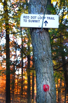
I decided to head back after lunch. Instead of taking the Skyline Trail back to Rt. 28 I decided to take the Sassaman Notch Path and the Bouncing Brook Path. On the DCR map it is marked in red dots indicating "rugged, rocky loops over hilly terrain." In actuality it's a wide path that is anything from challenging. As a matter of fact, the only thing challenging about this path is the fist sized loose rocks hiding under a blanket of leaves that move when stepped on. Nonetheless, it was a nice walk in the woods with far fewer people.


By 3:30pm, after having walked about a total of 11 miles, I was back on my bicycle heading toward the bus stop on my way home. It was definitely an enjoyable day of sauntering in the woods.


After stopping at the headquarters for a couple of minutes to drink some water and remove some layers (it was a lot warmer than I had expected it to be), I crossed the road and headed for Buck Hill. If you are looking for a solitary hike, this is definitely not the place for you… at least not on a nice day. There were quite a few boy scout troops, and other groups of people on the trail. While there was a lone tree atop Buck Hill (see the picture above), there were throngs of people having lunch. Not wanting to contend for a rock to sit on, I pressed on and finally had lunch Nahanton Hill -- the view wasn't as nice, but it was much quieter. I had taken my canister stove with me and so I made myself a nice cup of hot tea to go along with my sandwiches. A delectable lunch, if I may say so.


I decided to head back after lunch. Instead of taking the Skyline Trail back to Rt. 28 I decided to take the Sassaman Notch Path and the Bouncing Brook Path. On the DCR map it is marked in red dots indicating "rugged, rocky loops over hilly terrain." In actuality it's a wide path that is anything from challenging. As a matter of fact, the only thing challenging about this path is the fist sized loose rocks hiding under a blanket of leaves that move when stepped on. Nonetheless, it was a nice walk in the woods with far fewer people.
By 3:30pm, after having walked about a total of 11 miles, I was back on my bicycle heading toward the bus stop on my way home. It was definitely an enjoyable day of sauntering in the woods.

Yeah, the Hancock tower is only about 800 ft. But 1500 ft. is close enough I guess.
ReplyDeleteOops! That was the height of the Sears Tower in Chicago and I must have had trouble copy and pasting. =) Thanks for catching the error!
Delete