Showing posts with label hiking. Show all posts
Showing posts with label hiking. Show all posts
Monday, February 20, 2012
Fun In The Snow
A couple of weeks ago, at the end of January, my wife and I went up to the White Mountains for a little weekend getaway. I had just handed in my PhD thesis three days earlier and was looking forward to a couple of days of sun, fun, and snow. One of the days we took a walk along the Lincoln Woods Trail and Bondcliff trails (the same ones I had hiked when doing the Pemi-Loop in the summer) and so I took the opportunity to augment the usual picture taking with some video.


Monday, November 28, 2011
Day Hikes Near Boston, Massachusetts (USA)
The other day I wanted to go for a quick day hike, but I didn't really know where to go. Fortunately for me, there is a mailing list in the department where I am doing my graduate work (Computer Science and Artificial Intelligence Laboratory at MIT) that "spams" everyone and is meant for random questions just like this one. Although I ended up going to the Blue Hills, I thought that I would share the list of all places that were recommended to me. The list here is sorted in order of how often it was mentioned in an email (I received about 20 or so responses within 2 hours -- not bad, I would say!). For general information about parks and such, you can always check out the MA Department of Conservation and Recreation (DCR) website.
| Blue Hills | |
| Mt. Monadnock (Jaffrey, NH) | |
| Middlesex Fells | |
| Lynn Woods | |
| Wachusett Mountain | |
| The Trustees | |
| Mt. Everett (Western MA) | |
| Moose Hill Audubon | |
| Borderland State Park | |
| Boston Harbor Walk | |
| Lincoln, MA (e.g. Mt. Misery) | |
| Stony Brook Reservation | |
| Arnold Arboretum | |
| Wapack Trail (e.g. Mount Watatic) | |
| Babson Boulders (Gloucester, MA) |
Tuesday, November 15, 2011
How Long Will It Take From Point A to Point B: Book Time
When planning a trip, it is useful (and depending on where you are going, very important) to have a reasonable guesstimate of how long it will take you to get from point A to point B. Clearly, there are many factors that come in to play when calculating how long it will take for you to cover the 15 miles from where you packed up your camp in the morning to where you are hoping be setting up your tent that evening. These factors include, but are definitely not limited to, weather, weight of pack, difficulty of terrain, number of breaks, amount of sight-seeing, etc. And if you're traveling in winter, well, then the snow will definitely slow you down some more.
However, a rule of thumb that is often used is called "Book Time." This is a simple rule that assumes that you travel 2 miles an hour and adds an additional 30 minutes for every 1,000 ft of elevation gain. So, if you are traveling 10 miles and are expecting a 1,000 ft elevation gain over those 10 miles, the book time is 5.5 hours (5 hours for the distance, and 30 minutes for the 1,000 feet). Below you will find a simple calculator that will compute this for you. As a side note, a similar rule was put forth by Scottish mountaineer William Naismith in 1892 and is aptly named Naismith's Rule.
One thing to keep in mind is that book time is only meant to help you plan your trip. The more you hike, the more you are likely to know if this guideline fits your walking pace. Furthermore, you can adjust it accordingly and get a much more accurate time. Remember, if you are traveling in a group, you need to plan according to the slowest hiker.
Importantly, keep in mind that this is not meant as a measuring stick of how good of a hiker you are; just because you are slower than book time, doesn't mean you don't know what you're doing. Similarly, just because you are faster, doesn't mean you are enjoying your hike more than the slower person.
However, a rule of thumb that is often used is called "Book Time." This is a simple rule that assumes that you travel 2 miles an hour and adds an additional 30 minutes for every 1,000 ft of elevation gain. So, if you are traveling 10 miles and are expecting a 1,000 ft elevation gain over those 10 miles, the book time is 5.5 hours (5 hours for the distance, and 30 minutes for the 1,000 feet). Below you will find a simple calculator that will compute this for you. As a side note, a similar rule was put forth by Scottish mountaineer William Naismith in 1892 and is aptly named Naismith's Rule.
One thing to keep in mind is that book time is only meant to help you plan your trip. The more you hike, the more you are likely to know if this guideline fits your walking pace. Furthermore, you can adjust it accordingly and get a much more accurate time. Remember, if you are traveling in a group, you need to plan according to the slowest hiker.
Importantly, keep in mind that this is not meant as a measuring stick of how good of a hiker you are; just because you are slower than book time, doesn't mean you don't know what you're doing. Similarly, just because you are faster, doesn't mean you are enjoying your hike more than the slower person.
A Simple Book Time Calculator
Here is a simple calculator that uses the aforementioned rule to calculate the time (in hours) for your trip. Remember, this is only a guideline and should not be used as a hard and fast rule!
According to book time, your trip should take you 5.5 hours (5 hours for the distance, and 0.5 hours for the elevation gain).
Sunday, November 13, 2011
Skyline Trail, Blue Hills (Massachusetts, USA)
 |
| A panorama view from Blue Hill Observatory. Boston is that smattering of buildings in the distance. |
Planning
The Skyline Trail
The Skyline Trail is a very popular trail in the Blue Hills Reservation located south of Boston. This trail basically goes across the entire reservation from east to west (or west to east, depending on how you look at it). On the western end of the trail is Blue Hill (it goes on farther, but many people start/end there) and on the eastern end are the St. Moritz Ponds. According to this site, the full round-trip of the Trail is about 16 miles. However, if you have done any hiking in the White Mountains (or any other mountainous region), then this is not the same "16 miles" that you are used to. The highest peak (Blue Hill) is a whopping 635 feet (211 m) high. To put the into perspective, the John Hancock Tower in Boston is 790 ft (240 m). Oh, and the Sears Tower in Chicago is 1450 feet (442 m) high. So yes, not a very big hill. That being said, the Skyline Trail does go up and down, and those ups and downs are very similar to the ones you'll find in the White Mountains - just not as long or as steep. As for required footwear, well, you can pretty much wear whatever you want. I saw just as many people in hiking boots/shoes as I did in sneakers. On a nice day, it definitely makes for a nice comfortable hike. Although one can start at either end (or in the middle), I used public transportation to get to the Blue Hills, and thus started at the Trailside Museum on the western end of the trail and caught the Skyline trail at the "summit" of Blue Hill. As a side note, the Trailside Museum houses a bunch of animals and birds that is free to the public.
You can get the full PDF version of this map from the DCR website here. Alternatively you can buy a paper copy when you get there.
How Do I Get There?
There are many ways to get to the Skyline Trail (and the rest of the Blue Hills, for that matter) as there are a plethora of roads that cut right through the reservation. Furthermore, there are several MBTA buses that get pretty close to the reservation. For your convenience I've included links to Google Maps that are close to where you might want to start:West
Central
- Reservation Headquarters
- Skyline Trail on Rt. 28 (There should be a little parking lot by the side of the road)
East
There is more information on the DCR Blue Hills Reservation with detailed driving or public transportation instructions if you prefer not to use Google Maps to plan your trip.The Trip
As I was constrained by starting points in the Blue Hills that the MBTA services (or gets reasonably close to), I decided to hike the Skyline trail starting at the Trailside Museum on Rt. 138. This way, I could take the Orange Line out to Forest Hills and then take the 32 bus all the way to the end (Wolcott Square). While this still put me about 2 miles from the Trailside Museum, I took my bike along which made this a nonissue. I stepped out the front door at about 7am and was ready to march by 8:45 (of course, I stopped by my office on the way to the train station and made myself a nice cappuccino).

As alluded to in the Planning section, this wasn't the most strenuous of hikes. However, it was a nice sunny autumn day, perfect for a nice stroll in the woods. I had my camera with me and so I probably spent an equal time walking as trying to take photos (as you can see from some of the photos I snapped in the gallery above, "trying" is the operative word). The view from the observation tower atop of Blue Hill was definitely nice. For future reference, being up there at sunset would probably be a very beautiful view of Boston.


As the trail starting at the Trailside Museum isn't the Skyline Trail, I picked up the trail at the top of Blue Hill. I took the northern route and made my way over to the Reservation Headquarters. I wish I could say this was without incident, but alas, I took a wrong turn on top of Hemenway Hill (yes, that's how it's supposed to be spelled) and walked along some other path for about 0.5 miles. Amusingly, not 10 minutes earlier was I thinking to myself, "Wow, this Skyline Trail is really well marked." And it really is well marked, about every 4th or 5th tree has a light blue blaze on it. Of course, the problem is if you're busy admiring the scenery it's easy to just follow another path and forget about the blazes. If you do go to the Blue Hills, one of the first things you will undoubtedly notice is that you will come upon an intersection about every 10 minutes. So, don't be like me; keep a lookout as to where you're going!


After stopping at the headquarters for a couple of minutes to drink some water and remove some layers (it was a lot warmer than I had expected it to be), I crossed the road and headed for Buck Hill. If you are looking for a solitary hike, this is definitely not the place for you… at least not on a nice day. There were quite a few boy scout troops, and other groups of people on the trail. While there was a lone tree atop Buck Hill (see the picture above), there were throngs of people having lunch. Not wanting to contend for a rock to sit on, I pressed on and finally had lunch Nahanton Hill -- the view wasn't as nice, but it was much quieter. I had taken my canister stove with me and so I made myself a nice cup of hot tea to go along with my sandwiches. A delectable lunch, if I may say so.


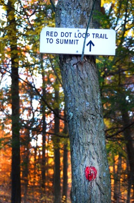
I decided to head back after lunch. Instead of taking the Skyline Trail back to Rt. 28 I decided to take the Sassaman Notch Path and the Bouncing Brook Path. On the DCR map it is marked in red dots indicating "rugged, rocky loops over hilly terrain." In actuality it's a wide path that is anything from challenging. As a matter of fact, the only thing challenging about this path is the fist sized loose rocks hiding under a blanket of leaves that move when stepped on. Nonetheless, it was a nice walk in the woods with far fewer people.


By 3:30pm, after having walked about a total of 11 miles, I was back on my bicycle heading toward the bus stop on my way home. It was definitely an enjoyable day of sauntering in the woods.


After stopping at the headquarters for a couple of minutes to drink some water and remove some layers (it was a lot warmer than I had expected it to be), I crossed the road and headed for Buck Hill. If you are looking for a solitary hike, this is definitely not the place for you… at least not on a nice day. There were quite a few boy scout troops, and other groups of people on the trail. While there was a lone tree atop Buck Hill (see the picture above), there were throngs of people having lunch. Not wanting to contend for a rock to sit on, I pressed on and finally had lunch Nahanton Hill -- the view wasn't as nice, but it was much quieter. I had taken my canister stove with me and so I made myself a nice cup of hot tea to go along with my sandwiches. A delectable lunch, if I may say so.


I decided to head back after lunch. Instead of taking the Skyline Trail back to Rt. 28 I decided to take the Sassaman Notch Path and the Bouncing Brook Path. On the DCR map it is marked in red dots indicating "rugged, rocky loops over hilly terrain." In actuality it's a wide path that is anything from challenging. As a matter of fact, the only thing challenging about this path is the fist sized loose rocks hiding under a blanket of leaves that move when stepped on. Nonetheless, it was a nice walk in the woods with far fewer people.
By 3:30pm, after having walked about a total of 11 miles, I was back on my bicycle heading toward the bus stop on my way home. It was definitely an enjoyable day of sauntering in the woods.

Wednesday, July 27, 2011
Pemi (Pemigewasset) Loop (New Hampshire, USA)
 |
| A panorama view from the top of Mt. Lafayette (Day 2). From here you can see all that you have hiked, and where you still have to go. |
Planning
To be honest, there wasn't all that much planning that went into this trip. On Thursday, I found out from my PhD advisor that my dissertation defense date that was scheduled for 3 weeks from today was moved back 5 months, and so I thought, why not go to the mountains? So, by the following day I had my bag packed, some dehydrated dinners prepared, and a car rented (I got a great last-minute deal online). As I had to return the rental car and be back at the office on Monday, I had to do the entire hike in 2.5 days... a bit rushed, but doable. It would have been a much more comfortable hike in 3.5 days, but 2.5 was definitely feasible.
Pemi Loop, Which Trail Is That?
As others have pointed out, the Pemi Loop isn't an actual trail per se, so there are no trail markers that say "Pemi Loop." The loop consists of the following trails (listed in the order that most people hike them) that happen to make a nice long 32 mile hike:- Lincoln Woods Trail
- Osseo Trail
- Franconia Ridge Trail
- Garfield Ridge Trail
- Twinway Trail
- Bondcliff Trail
- Lincoln Woods Trail
- Mt. Flume (4328 ft)
- Mt. Liberty (4459 ft)
- Little Haystack Mountain (4780 ft)
- Mt. Lincoln (5089 ft)
- Mt. Lafayette (5260 ft)
- Mt. Garfield (4500 ft)
- South Twin Mountain (4902 ft)
- Mt. Guyot (4580 ft)
- Mt. Bond (4698 ft)
- The Cliffs (4265 ft)
If you haven't noticed, this trail is nothing but hiking from peak to peak along ridges. I believe that the total elevation gain adds up to about 9000 feet. To put that in perspective, Mt. Everest is 29,035 feet high and Base Camp is somewhere in the vicinity of 17,700 feet. So, during the course of the 32 miles you climb about 2000 fewer feet than when climbing Mt. Everest. Of course, that speaks nothing of the much, much (much, much) more demanding conditions found on Everest. In any case, if you don't much like hiking up and down sometimes very steep inclines, I would stay away from this one. Also, if you know you have knee problems, this one might not be the one for you... my knees generally don't bother me much, and it very well could have been the fault of my choice of boots, but by the end of each day it wasn't usually fatigue that made me want to throw my pack down and curl up under a tree (or rock on the ridge) but rather the pain in my knees.
How Do I Get There?
If you have a car, the easiest way is to get yourself to Lincoln, NH (right off of I-93), and drive along the famous Kancamagus Highway for 5 miles to the Lincoln Woods Trail Head (on the left).If you don't have a car you can either try your luck with the Greyhound bus that stops off at Lincoln at 9pm once a day, or go with the Concord Coach Lines that is a bit more convenient (and cheaper) but has a much more limited route. Of course, you then still have to make your way to the trail head somehow.
Water, Where Can I Find Some?
There are a bunch of "official" places along the loop where you can refill your water bottles/hydration packs. Listing them in the order of the trails above, they are:- Lincoln Woods trail head
- Liberty Springs Tent Site (a 0.3 mile hike down the Liberty Spring Trail from the ridge)
- Garfield Ridge AMC Camp Site
- Galehead Hut
- Guyot AMC Shelter and Tentsite
Where Can I Sleep?
Technically speaking, you can camp anywhere along the trail as long as 1) you are below the tree line (unless there is 2 feet of snow), and 2) not within a 1/4 mile of any AMC run hut/tent site or road. Also, if you are staying in the alpine zone, which is clearly marked on the trail, you have to use a stove to cook your meals. Since the rules can change it is best to check out the official rules from the US Forest Service here.Although I can't guarantee that these clearings will still exist when you get there, there are a couple of clearings on the Franconia Ridge before you reach Little Haystack Mountain. As a matter of fact, I stayed at one of them that was just below the tree line and had a perfect view of the western sky. There are also some other clearings on the Garfield Ridge between Mt. Lafayette and Mt. Garfield, but there isn't much of a view (except for trees).
If you prefer more established locations, the tent sites charge (in 2011) $8 a night per person and provide you with either a wooden platform to pitch your tent or a wooden shelter to sleep in (Guyot Tent Site only). You also get the wonderful amenities of a water source and an outhouse (shall we say 5 stars, anyone?). The huts (Galehead Hut and Green Leaf Hut 1.1 miles down the Bridle Path from the summit of Mt. Lafayette) provide you with a bunk to sleep in, warm food, and access to clean water. Of course, they charge quite a bit more for all of this.
The Trip
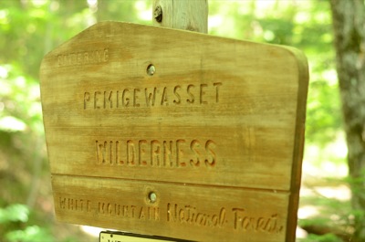
Day 1
The day started with me strapping on my pack and biking 5 miles through the city to the car rental place (getting a car for $19 a day does come at a price of convenience). It turned out to be one of the hottest days of the year and by the time I got to the rental place at 8am, I was dripping with sweat -- what a great way to start. On the bright side, I had a 2 hour drive to cool down.


By a little after 11:30am I had paid my parking fee ($3 a day) at the Lincoln Woods trail head, filled my water bottles and was making my way down the Lincoln Woods Trail. The first thing that I noticed was the very annoying placement of wooden planks across the path. They are just far enough apart that it's hard to step from one to the next, but too close together to not have to step on them every now and then. Only later was my suspicion that these were railway ties confirmed when I asked a park ranger. It turns out that the Lincoln Woods Trail and Bondcliff trails (and probably other trails as well) were part of the logging industry in the past and there were railway tracks that were used to take the lumber out of the woods. As a matter of fact, you can still see old clearings where the workers slept, a single iron railway track, and an old metal railway car suspension along the Bondcliff Trail.

Unlike most people that go clockwise, I thought, I've already seen the stretch from Mt. Lincoln to Mt. Lafayette, so I'll hike the trail in the opposite direction so that I'll end with Mt. Liberty (actually, the last summit is Mt. Flume); thus starting with the Bondcliff Trail and ending with the Osseo Trail. The first 80% of the trail isn't bad at all -- there aren't any steep inclines and it's quite a nice walk in the woods. The trail does cross the Black Brook several times, so if it's been raining a lot, you might want to be prepared to get some wet feet. I ate my lunch (a very tasty peanut butter sandwich, and an even tastier Nutella sandwich) sitting in the sun on a rock in a dried up stream. By around 3:15pm I reached the top of The Cliffs and sat there soaking up the sun. I asked someone to take the obligatory photo of me standing on the cliffs, but immediately regretted it. Standing out on the ledge with nothing but sheer cliffs on three sides and gusts of winds blowing at 40 miles an hour wasn't all that great for my nerves (if you look at the picture, you'll clearly see I wasn't all that comfortable). I was most definitely very happy when I was able to gingerly turn around and head back to retrieve my camera from the other hiker.

I left The Cliffs a bit before 4pm and crossed over the summit of Mt. Bond and trudged in to the Guyot Tent Site sometime after 5pm. As it was a Friday evening of a weekend with nothing but sunshine in the forecast, it is an understatement to say that the campsite was full. I ended up sleeping in the wooden shelter/hut with 4 other guys (the warden just made all hikers that were traveling alone sleep in the hut to give the tent platforms to the larger groups). By 8:30pm, my stomach was filled with instant mashed potatoes, re-hydrated vegetables and chicken, and a nice cup of hot chocolate, I had read several chapters of Bill Bryson's "A Walk In The Woods
 " (yes, it's quite ironic that I was reading a book about hiking the Appalachian Trail while hiking myself), and was comfortably lying inside my down hiking quilt and counting some sheep.
Day 2
This was a long day, by the end of which I had been on six of the ten peaks. As usual, I was woken up by the morning light and was up and about before 7am. I enjoyed my oatmeal with bananas (that I had dehydrated for the trip) and a nice cup of hot coffee that I prepared on my new Snow Peak LiteMax canister stove (that worked splendidly). Amusingly, we had quite the collection of stove types between the 5 of us in the hut. One guy had a JetBoil
 canister stove, another had the MSR Whisperlite
 liquid fuel stove, and the other two shared a homemade alcohol stove similar to the one I used on my previous trip. If only we had someone with an esbit stove, we would have had pretty much all types of hiking cooking equipment.
 After departing the camp ground, which was made quicker by the fact that I didn't have a tent to pack up, I quickly reached the summit of Mt. Guyot about half a mile away at around 8:30am. After crossing the nice alpine ridge between Guyot and South Twin, I made a relatively quick descent to the Galehead Hut where I re-filled one of my water bottles. I must say, the view from the hut was quite spectacular (I stupidly forgot to take a photo) as it is nestled between the peaks with a grand view of the entire valley. If it wasn't for the fact that I still had three peaks to climb I would have stayed longer than 15 minutes and enjoyed the tranquil surroundings.
The hike from the hut to Garfield wasn't anything spectacular. Not that it wasn't nice being in the woods, but the only time that you have a clear view of the peaks, you just realize how far you have descended and how far you have to climb back up. The fun part really begins about 100 feet from the Garfield Tent site. Why you ask? Well, because you have to climb what is probably a 100 foot "water fall" to get to it. Yes, it's pretty much straight up. I was definitely glad to be going up this pile of rocks and not going down. I was also very glad that it hadn't rained in a while and the water was a mere trickle… boy would this not be fun with completely wet rocks. The only consolation at the top was that I could re-fill my water bottles (for the last time) before reaching the summit of Garfield and continuing on to Lafayette.
By 1pm I had reached the summit of Mt. Garfield and was happy to extract my tired feet from their hiking boot prisons. I chowed down my two tuna fish wraps and peanut butter wrap, snapped some photos and was on my merry way. The first part of the Garfield Ridge Trail is very similar to the other wooded areas, trees on either side a dirt path littered with rocks both in front and behind you. Once you get above the tree line, however, you are presented with the spectacular view of the entire area (and gusts of wind up to 60 miles per hour). After some scrambling up rocks, chatting with fellow hikers (and petting their dogs), I finally reached the summit of Mt. Lafayette at a little after 4pm. I spent about half an hour on the peak talking to other people and just generally enjoying the warm afternoon.

Noting that I still had a couple of miles ahead of me, I lifted up my pack again and made my along the Franconia Ridge Trail over to Mt. Lincoln and Little Haystack Mountain. Apart from the approaches to the peaks to the two summits, most of this section is downhill as Mt. Lafayette is the tallest of the bunch (of all of the peaks on the Pemi Loop, as a matter of fact). This normally wouldn't be a problem, rather it probably would be a welcome change to most, but my knees were not feeling in very good shape. When I found that someone had left a wooden stick along the path, I was very glad to pick it up and use it as my walking stick for the rest of the way.

I recalled from my previous trip that there were a couple of clearings along the ridge right below the tree line after passing Little Haystack. So, I made up my mind that I wasn't going to walk the last 1.5 miles to the Liberty Spring Tent Site, but rather set up shop a bit early. The up side was that I didn't have to walk any farther, it was free, and that I had a fantastic view of the mountains on the other side of the valley. The downside, however, was that I only had half a liter of water left. Thus, instead of having what was slated on the menu for that night (mashed potatoes with re-hydrated tomato sauce and vegetables), I ate my following day's lunch instead (which, incidentally, was the same as the lunch I had not too long before). I did, however, heat up some water for a nice cup of hot chocolate that I enjoyed whilst looking out over they valley below.
Day 3
 |
| This is what I woke up to on Sunday morning. Not a bad way to start the day! |


The trip over to Mt. Flume was relatively quick, although there is an uphill section that seems to go on forever. Unlike most other parts of the trail where the uphill sections are of varying steepness, here it seemed to be a constant incline for a while. But, once you reach the top you are rewarded with the final view of the area before you descend for the last time back down to the Lincoln Woods Trail on the Osseo Trail. Of course, before you get to the Lincoln Woods Trail, you have to go down probably the steepest section of the entire 32 miles. But, before you worry, the maintainers of the trail (AMC) were kind enough to put in wooden steps that make it rather easy.

About a 1/4 mile before the Osseo Trail meets up with the Lincoln Woods Trail it follows a little stream. Although I didn't need it to get water, I did need it for a little cleaning. It was nice to be able to soak my feet in the cold water and wash the sweat off of my face and out of my hair before getting back to civilization. The last mile back to the parking lot on the Lincoln Woods Trail went very quickly as it is nearly flat (apart from those darn railway ties). And that was it, by around 2:30pm my pack was in the trunk of the car and I was on my way home. Although I was happy to be heading back to see my wife, I am definitely looking forward to when I get to go back.
Tuesday, June 21, 2011
Mt. Lafayette (New Hampshire, USA) via Liberty Spring Trail

Day 1

I left the parking lot by the Flume visitor center at around 2pm on a beautiful Friday afternoon. The sky was blue with only a couple white clouds that provided intermittent cover from the sun. I realized a bit late (i.e. when i had my pack on and car doors locked) that there is a parking lot a bit farther down the road that is closer to the trailhead. But then again, using that logic I could just forgo hiking and drive to the nearest cinema. So, if you happen to make this mistake too, all you have to do is follow the bike trail for a bit and then when the road splits, take the road less traveled (the bike trail is paved, but the way you want to go is the unpaved way). This should lead you to the "correct" parking lot where the trail actually begins.

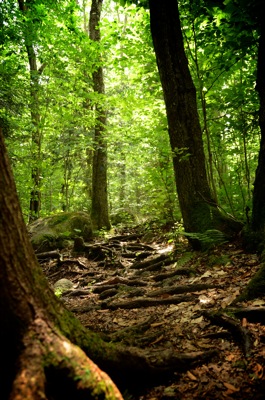


As many have said, the path to where the Liberty Spring Trail (LST) begins is very flat and can be walked in no time -- part of it is paved as it is also a bike trail. If so inclined, one can take a quick detour and go down to the river that flows right by the path. After about 20 minutes or so, I arrived at the point where the trail splits and the LST heads away from the bike path and up towards Mount Liberty and the Liberty Spring Campsite. It was easy going for the first 30 minutes or so, but then things got a wee bit steeper. Actually, from there on out, it was pretty much stepping from rock to rock on what seemed to be a never ending stair case. I don't think it was as steep as the Grouse Grind in North Vancouver, Canada, but it goes on for longer. Fortunately for me, I met some nice people along the way that I stopped to chat with giving my legs some rest.
After about 2.5 hours of hiking I made it to the campsite where I was the third person to show up. I stopped by the caretaker's tent (the campsite is run by the Appalachian Mountain Club) who told me that the tent platforms are on the left and that water is on the right. I ended up taking the first small platform (I mean, there is no need for me to use up a large platform for my 1 person tent), set up the tent and started chatting with the folks around. At around 5:30pm I took out my home made alcohol penny stove and my rice and dehydrated vegetable and turkey dinner. Only then did I realize that the first thing that I should have done was to put my dinner in water and let it soak for at least 30 minutes before cooking it. Alas, although I got both the water for the hot chocolate and my dinner to boil using about 1 ounce of denatured alcohol (2 tablespoons), the meat never got soft and was akin to turkey jerky.


Day 2

After crawling out of my tent at 6am, I lit my stove to heat up my oatmeal that contained some dehydrated strawberries and blueberries and made a nice cup of instant milk coffee. Fortunately for all of us at the camp site, the light rain subsided for the breakfast, resulting in a nice meal that wasn't interrupted by pesky mosquitoes. Rain is definitely nature's best bug repellant. By 7:30 my stomach was full, the mess kit cleaned, the tent put away, my hiking quilt tucked away safely in its dry sack, and my water bottles filled with nice cold mountain water. I followed the trail up to Mt. Liberty where I had the best views of the day... I actually saw across the valley and could make out the peaks on the other side. I made my way back down from the summit and hiked along the Franconia Ridge Trail to Mt. Lafayette. Unfortunately for me and the other fellow hikers that day, the conditions were nothing short of miserable. We had gusts of wind up to 40 miles/h, freezing rain, and the constant dampness of the mist. While on a nice day the occasional trees and shrubberies would distract from the views offered on the ridge, today they provided me with a nice break from the constant onslaught of the wind. After making my way down from the summit of Mt. Lafayette on the Old Bridle Path, I was definitely very glad for the respite from the cold offered by the Greenleaf Hut where I enjoyed my tuna wrap followed by a decadent peanut butter, honey, and chocolate chip wrap. I followed the Old Bridle Path down back to the main road where I had a cold and wet 3 mile walk back to the parking lot. By 3pm I had changed out of my soaked clothing into a dry pair of shorts and t-shirt and was headed back to the concrete jungle.
Sunday, April 10, 2011
Baden-Powell Trail & Grouse Grind, Vancouver (Canada)

What better way to kick off a new blog than with a hike in North Vancouver, BC, Canada. At the end of March I was in Vancouver for a research related conference for a couple of days and thought that a good way to spend a day would be to go for a little hike. So, that's what I did. I packed a sandwich for lunch and headed out the door at about 9 in the morning to the Baden-Powell trail in North Vancouver. Unfortunately there were some self inflicted public transportation delays and it took me 2 hours to get myself to the trailhead instead of the planned 50 minutes. (I happened to miss both the SeaBus – why they couldn't just call this a ferry, I don’t know – and the connecting bus, thus adding an extra 30-minute wait time at each location.)
View Trail in a larger map. Note, this path is only approximate.
It was a typical Vancouver day for the season (cloudy with some rain), but once under the canopy of trees, it was actually quite dry and warm. The trail started out with a massive wooden "staircase" and then leveled off for a while. There were several mountain bikers that were making use of the relatively dry weather to thunder down the mountain. After passing over several small streams on nice wooden bridges, I had the pleasure of encountering a slightly larger "ravine" that had to be traversed by holding on to a rope on either side for support. According to one of the ski patrol guys that I talked to at the Grouse Mountain ski lodge, they had to rescue a couple of people the week prior after they slipped and couldn't make their way back up to the rope. So yes, "Caution, slippery when wet."


After sitting down on a log and enjoying my sandwich and tea biscuits, I came to the joyous Grouse Grind, affectionately known as "mother nature's stair master." I can assure you, the name is well deserved. About halfway up the mountain the signs of snow began to emerge with spots of packed snow on the trail. About 15 minutes later, the dirt under my shoes was gone and was replaced by a blanket of snow – boy was I glad that I brought my hiking shoes and not just some running shoes. 15 minutes after that, the unpacked off-trail snow was at least hip high (I figured this out the hard way when I took a little detour to try to get a view of the city; all I got was a view of a cloud-enveloped downtown and a nice dip in the snow).


Three and a half hours after setting off from the bus stop, I made it to the ski lodge on Grouse, and enjoyed a nice cup of warm tea amongst skiers and snowboarders. After resting my feet for a while, I proceeded to the information booth to ask where the trail forks so that I could get to the bottom of the mountain instead of back on to the Baden-Powell trail. The lady behind the counter kindly informed me that the trail, the very one I had just traversed, was closed until June. Oops. So as not to ruffle any feathers, I paid her $10 for a 1-way gondola ticket. On the bright side, my hike concluded with a nice quick ride down the side of the mountain leaving me enough time to get back to the hotel, shower, and make it to the opening reception of the conference.


Subscribe to:
Posts (Atom)